Weather Briefing: Bitter Cold and Ice Means Dangerous Roads
Tuesday 4:30 pm – The first bands of light snow are moving through the Birmingham area. Total accumulations are projected to be small — no more than 1.5 inches — but impacts will be serious due to the cold temperatures, according to the National Weather Service in Birmingham. Temperatures will fall into the teens and 20s this afternoon and evening. The snow effects will linger through Wednesday morning.
Brian Hastings, director of the Alabama Emergency Management Agency, warned residents about worsening road conditions Tuesday afternoon.
Birmingham—this is not a snow storm…this is an ICE EVENT. Road conditions are going to worsen & bridges/overpasses are going to be slick. #BlackIce is dangerous! If you are on your way home, slow down & drive for conditions. Get somewhere safe & warm ! @AlabamaEMA @EMAJeffCoAL
— Brian Hastings (@B_Hastings_EMA) January 16, 2018
Roads and bridges in Fayette and Winston counties have been deemed impassable. WBRC reports an overturned tractor trailer on U.S. 280 was related to the weather.
Just received an update from police on scene and it appears this accident was weather related. @WBRCnews pic.twitter.com/INUJM5DDk1
— Jamiese Price (@ThePriceReport) January 16, 2018
Temperatures are expected to continue to drop significantly through the evening and Tuesday night. Any melted snow on the roads will freeze and lead to hazardous travel conditions, the National Weather Service says.
Tuesday noon – No snow yet around Birmingham, but officials report dangerous road conditions in some parts of the state. The Alabama Law Enforcement Agency says it’s beginning to see weather-related crashes throughout northwest Alabama along with icing on bridges. They continue to recommend staying off roadways if possible. There are slick roads in Cullman County. A few cars have slid off the road in Winston County, though no injuries were reported. And a truck flipped on I-85 in Montgomery.
#BREAKING: Truck has flipped on the I-85 SB ramp heading to I-65 SB in #Montgomery. #alabamatraffic #algo pic.twitter.com/usQCSO7y14
— Alabama News Network (@ALNewsNetwork) January 16, 2018
The snow is expected to move into the Birmingham area this afternoon. The National Weather Service in Birmingham projects accumulations of less than one inch. Low temperatures tonight will be 12 degrees with wind chill as low as -2.
Tuesday 9 am – The National Weather Service in Birmingham says with up to 1 inch snow accumulation, the area won’t see anywhere near the snowfall totals the state saw in December, but the impacts could be far worse. That’s because of very cold temperatures in the forecast. Temperatures will fall throughout the day dropping down to the 20s this afternoon. Snow is expected to start falling in Birmingham, Tuscaloosa, Anniston and Gadsden sometime from 10 am to 2 pm. And state officials say once the snow starts to fall, it will turn to ice, making roads extremely hazardous.
Please help share this message, please do not allow projected snowfall amounts to determine your level of concern – snow will occur at the same temps are dropping, resulting in travel issues #alwx https://t.co/d4Qgn1V1Cb — Alabama EMA (@AlabamaEMA) January 16, 2018
The Alabama Department of Transportation is treating roadways, giving major interstates and highways priority. As of 8 am, the National Weather Service in Huntsville received reports of slick roads. Snow began to fall in northwest Alabama earlier this morning. Officials and meteorologists advise people to stay off the roads except in an emergency.
UPDATE: With the steady progression of the snow, we recommend no travel in Tuscaloosa/Birmingham/Gadsden after 10am. Conditions will deteriorate rather quickly once the snow begins. pic.twitter.com/512jfJPxuC
— James Spann (@spann) January 16, 2018
Drivers can find updates on traffic and road conditions here.
Many schools closed in anticipation of the severe weather. And Gov. Kay Ivey declared a State of Emergency Monday evening to be able to mobilize state agencies in the event they’re needed.

Forget the State of the Union. What’s the state of your quiz score?
What's the state of your union, quiz-wise? Find out!
Nancy Guthrie case: How do families of missing people cope with the uncertainty?
When a loved one goes missing, relatives can feel guilty simply for eating, says Charlie Shunick, whose sister was kidnapped. Shunick now helps others navigate a nightmare "nobody is prepared for."

As the U.S. celebrates its 250th birthday, many Latinos question whether they belong
Many U.S.-born Latinos feel afraid and anxious amid the political rhetoric. Still, others wouldn't miss celebrating their country
US military used laser to take down Border Protection drone, lawmakers say
The U.S. military used a laser to shoot down a Customs and Border Protection drone, members of Congress said Thursday, and the Federal Aviation Administration responded by closing more airspace near El Paso, Texas.

Deadline looms as Anthropic rejects Pentagon demands it remove AI safeguards
The Defense Department has been feuding with Anthropic over military uses of its artificial intelligence tools. At stake are hundreds of millions of dollars in contracts and access to some of the most advanced AI on the planet.
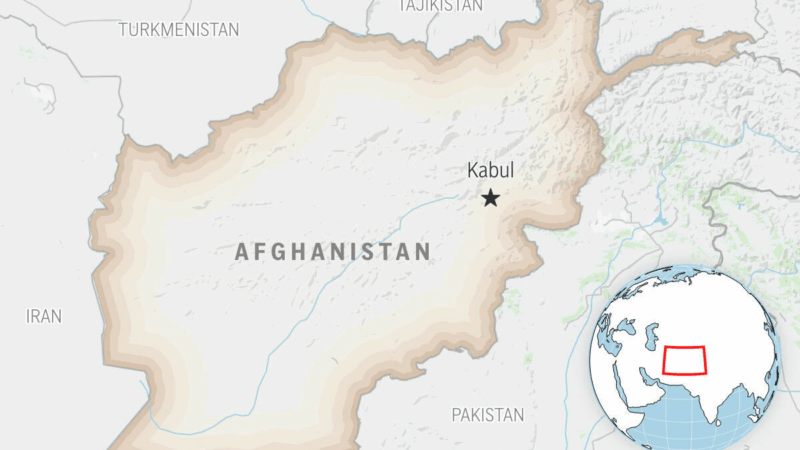
Pakistan’s defense minister says that there is now ‘open war’ with Afghanistan after latest strikes
Pakistan's defense minister said that his country ran out of "patience" and considers that there is now an "open war" with Afghanistan, after both countries launched strikes following an Afghan cross-border attack.