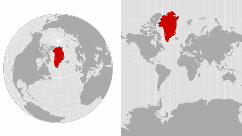
How large is Greenland, really? Your map may be deceiving you
President Trump is again floating the idea of annexing Greenland, the semiautonomous Arctic island that is a territory of Denmark.
Greenland’s location between North America and Russia gives it strategic value for the U.S., which already has a military base there. “We do need Greenland, absolutely,” Trump said on Sunday. “We need it for defense.”
If all this talk makes you want to check out Greenland on a map, you might notice its size. Greenland is the world’s largest island, covering more than 836,000 square miles.
But is Greenland really as large as it might appear on a map? Turns out, it depends on the map.
Though globes offer a pretty accurate picture of the world’s geography, things get a lot trickier when you try to depict a sphere on a two-dimensional surface. The shapes and sizes of land masses can get distorted, and distances and directions risk becoming wonky. There are many different types of world maps, and each one has its strengths and weaknesses.
One of the most common map types is called the Mercator projection, named for the 16th-century Flemish cartographer who invented it. This is the one you may have seen in an atlas as a kid, and a version of it is used in online mapping tools such as Google Maps.
Mercator’s map takes the Earth’s latitudes and longitudes (parallels and meridians) — which curve around the spherical globe — and makes them straight lines.
This allowed sailors to plot a course between any two points using a straight line, but it also created distortions in the map the further you got from the equator. For example, Greenland appears roughly the same size as the continent of Africa on a Mercator map, even though Africa is about 14 times larger.
“Mathematically [the parallels and meridians] get pulled apart, pulled in different amounts and magnitudes from the equator towards the poles, so you end up with this sort of exaggerated effect, if you will, in the upper latitudes where landmasses look huge,” said Fritz Kessler, a Penn State geography professor and map projection expert.
There have been organized efforts to move away from the Mercator projection and use alternatives that offer a more accurate view of relative land size. The Robinson projection, which tries to better balance the sizes and shapes of land masses, sought to solve the “Greenland problem.” And last year, the African Union threw its support behind a push to replace Mercator with the Equal Earth map, which better renders the continent’s scale.
But which of the numerous map projections you pick at a given time really depends on what you’re using the map for, according to Kessler.
“Is it going to be used to measure distances or directions? Angles? Areas? Show distributions of thematic data, you know, population?” he said. “There’s hundreds of projections that can be used, and the fact that we focus on just a very narrow subset is I think another problem that should be addressed.”
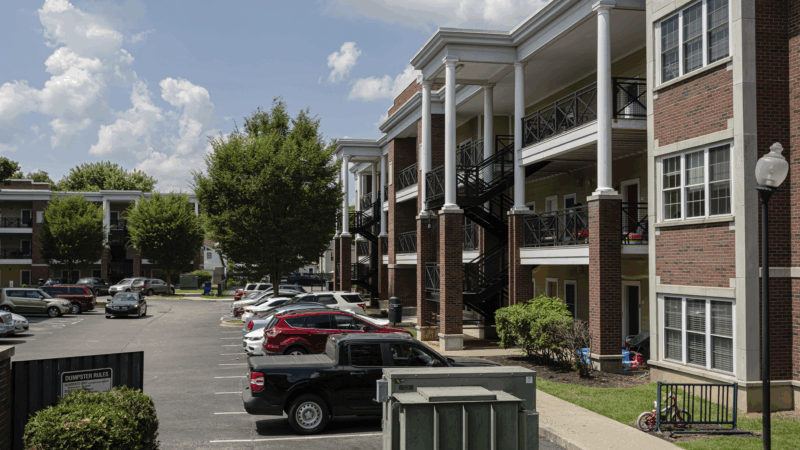
HUD proposes time limits and work requirements for rental aid
The rule would allow housing agencies and landlords to impose such requirements "to encourage self-sufficiency." Critics say most who can work already do, but their wages are low.
Paramount and Warner Bros’ deal is about merging studios, and a whole lot more
The nearly $111 billion marriage would unite Paramount and Warner film studios, streamers and television properties — including CNN — under the control of the wealthy Ellison family.
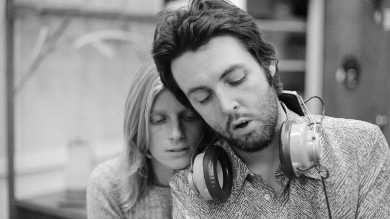
A new film follows Paul McCartney’s 2nd act after The Beatles’ breakup
While previous documentaries captured the frenzy of Beatlemania, Man on the Run focuses on McCartney in the years between the band's breakup and John Lennon's death.
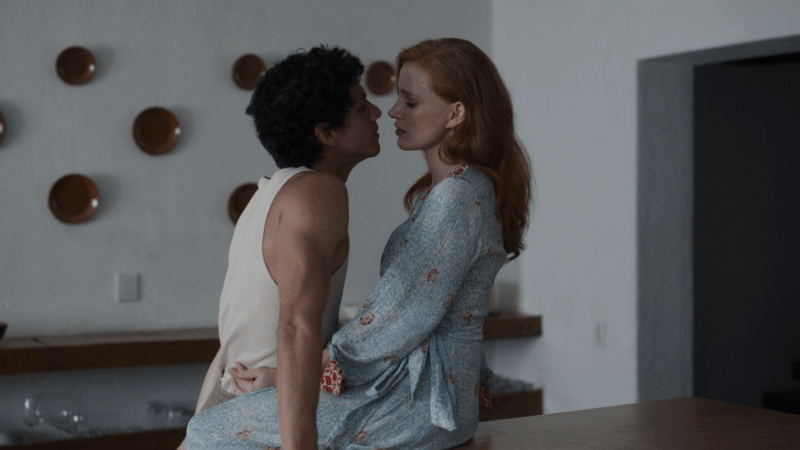
An aspiring dancer. A wealthy benefactor. And ‘Dreams’ turned to nightmare
A new psychological drama from Mexican filmmaker Michel Franco centers on the torrid affair between a wealthy San Francisco philanthropist and an undocumented immigrant who aspires to be a dancer.
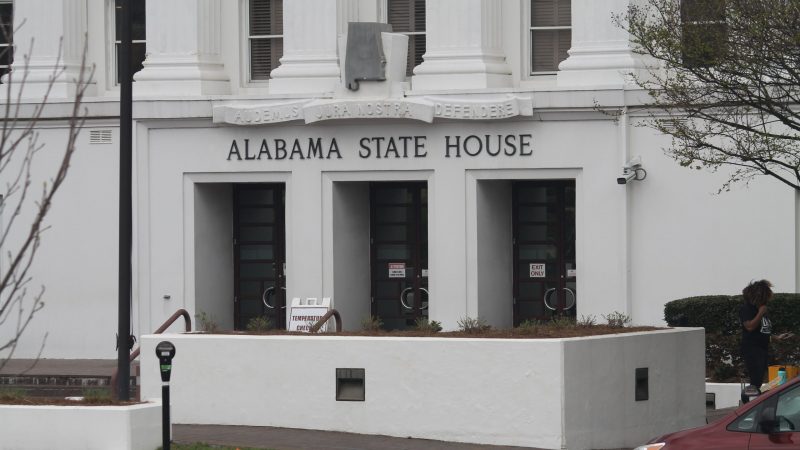
Bill making the Public Service Commission an appointed board is dead for the session
Usually when discussing legislative action, the focus is on what's moving forward. But plenty of bills in a legislature stall or even die. Leaders in the Alabama legislature say a bill involving the Public Service Commission is dead for the session. We get details on that from Todd Stacy, host of Capitol Journal on Alabama Public Television.
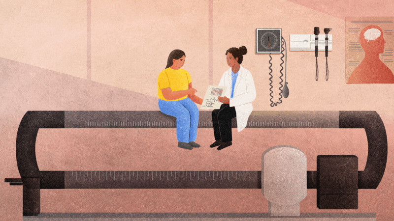
My doctor keeps focusing on my weight. What other health metrics matter more?
Our Real Talk with a Doc columnist explains how to push back if your doctor's obsessed with weight loss. And what other health metrics matter more instead.