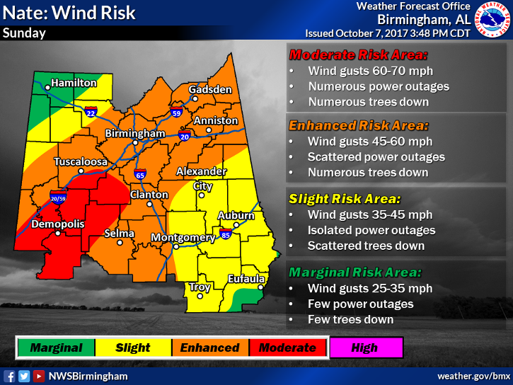
Alabama state meteorologist Jim Stefkovich Saturday afternoon warned that Hurricane Nate could bring sustained winds up to 100 mph and gusts up to 115 mph when it makes landfall along the Gulf Coast Saturday night. Because of those high winds, the storm’s impact on Alabama is expected to be dramatically greater than Irma, he said.
Counties along Alabama’s coast are expected to be hit the hardest, but most of the state will experience heavy winds and rain. Nate will produce rainfall from 2 to 6 inches, mostly southeast of the I-20/59 corridor. Storm surge along the coast could reach as high as 10 feet. Tornadoes are possible for the southern third of state Saturday and the southern two-thirds of the state on Sunday.
“I cannot stress enough, Hurricane Nate is an Alabama storm,” Alabama Emergency Management Agency director Brian Hastings said. “This is our storm and it’s going to affect all of us.”
Gov. Kay Ivey urged residents to finish storm preparations by sundown Saturday. She recommended stocking up on food, water, medications, batteries, and charging electronic devices. Not sure what to include in an emergency kit? The Department of Homeland Security issued this guide.
Storm shelters have opened in Mobile and Baldwin counties. Helena City Hall will open as a shelter at 11 pm Saturday.
The storm is moving quickly, so major impacts are expected to end by late Sunday night or by sunrise Monday. Tropical storm warnings and watches are in effect for much of Central Alabama through 10 pm Sunday. Those are issued when sustained winds of at least 39 to 73 mph are expected.
State officials said power crews are ready to respond to outages, which are anticipated throughout the state, along with several downed trees.

