

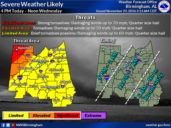
Strong storms with heavy rain, hail, and possible tornadoes are forecast in Birmingham and north central Alabama this afternoon and into early Wednesday morning, according to the National Weather Service.
Birmingham is under a “limited” risk for severe weather, which means the area could have winds up to 60 mph, quarter-sized hail and brief tornadoes. Parts of Tuscaloosa and west Alabama are under an “elevated” risk for severe storms with winds up to 70 mph, quarter-sized hail and tornadoes. The most significant risk for the state is the northwest area around Hamilton where strong tornadoes are in the forecast.
The weather service says the greatest threat for supercells is after 7 p.m. across the northwestern part of the state. As the weather system moves east, the threat should transition into a line of storms still capable of producing damaging winds.
This will be the second day of significant rain in Alabama this week. The weather service recorded 1.5 inches in Birmingham between Monday and early today. The next round of storms could produce another 1 to 1.5 inches of rain, according to the weather service.